The U.S. Rezoning Database
Find sites early.
Live record of rezonings across U.S. growth markets.
“If your edge is getting to a site before the market knows it is a site, this is the tool you have been waiting for someone to build.”
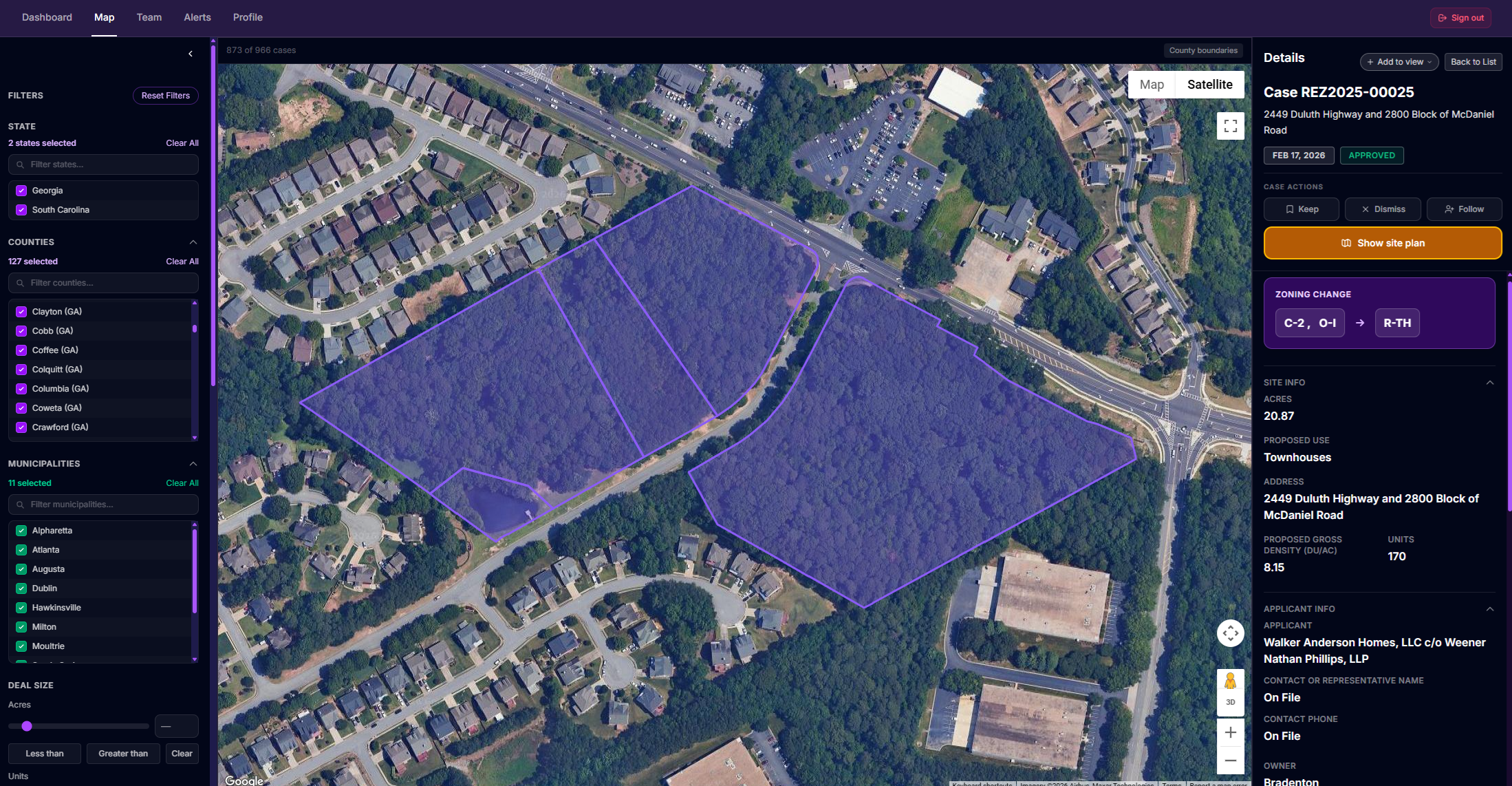
Contact name and phone number redacted for public materials. Full information available in-app.
Latest from LandScout
Metro AtlantaAlpharetta, GA
Alpharetta Approves 99-Acre North Point Mall Redevelopment After Mayor Breaks 3-3 Tie
See the future of your market.
View every rezoning across your market in one live map.
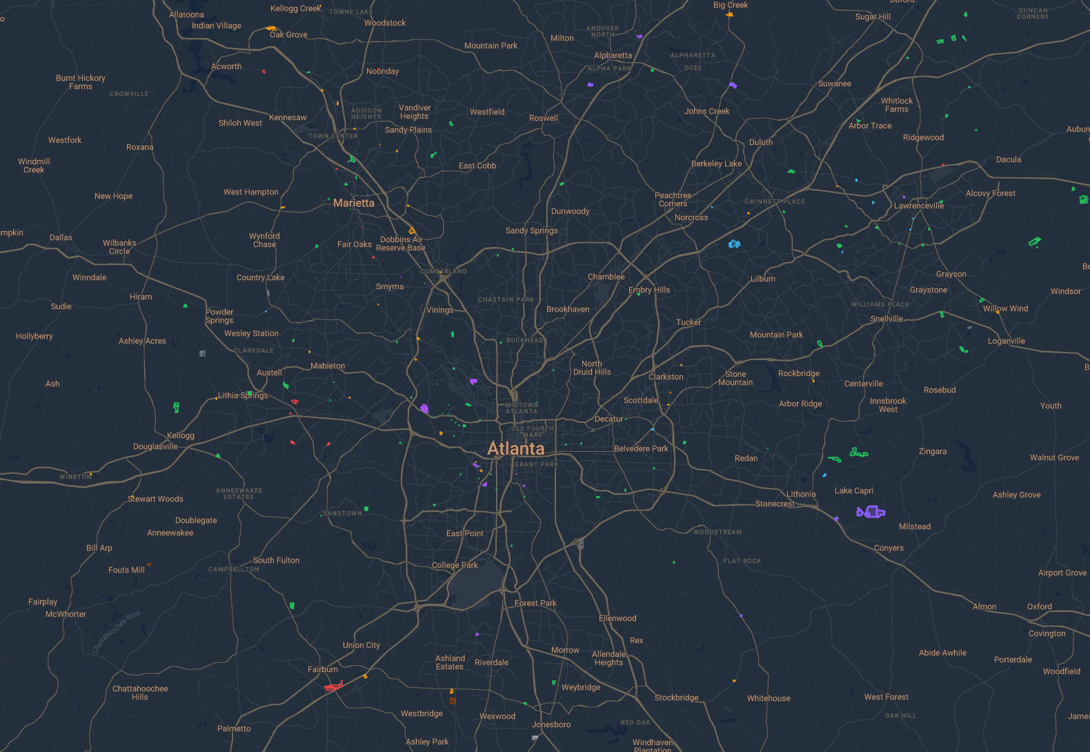
Atlanta Metro
- Industrial
- Residential
- Commercial
- Mixed Use
- Office & Institutional
- Agricultural & Rural
- Public & Open Space
- Planned & Special
Also mapped: Office & Institutional · Agricultural & Rural · Public & Open Space · Planned & Special
Every case tells the full story.
Open any case to see all available data behind the rezoning.
- Property address and parcel IDs
- Zoning change
- Proposed use and units
- Applicant and owner info
- Contact or representative info
- Case history and decisions
- Source documents and plans
- Case following and alerts
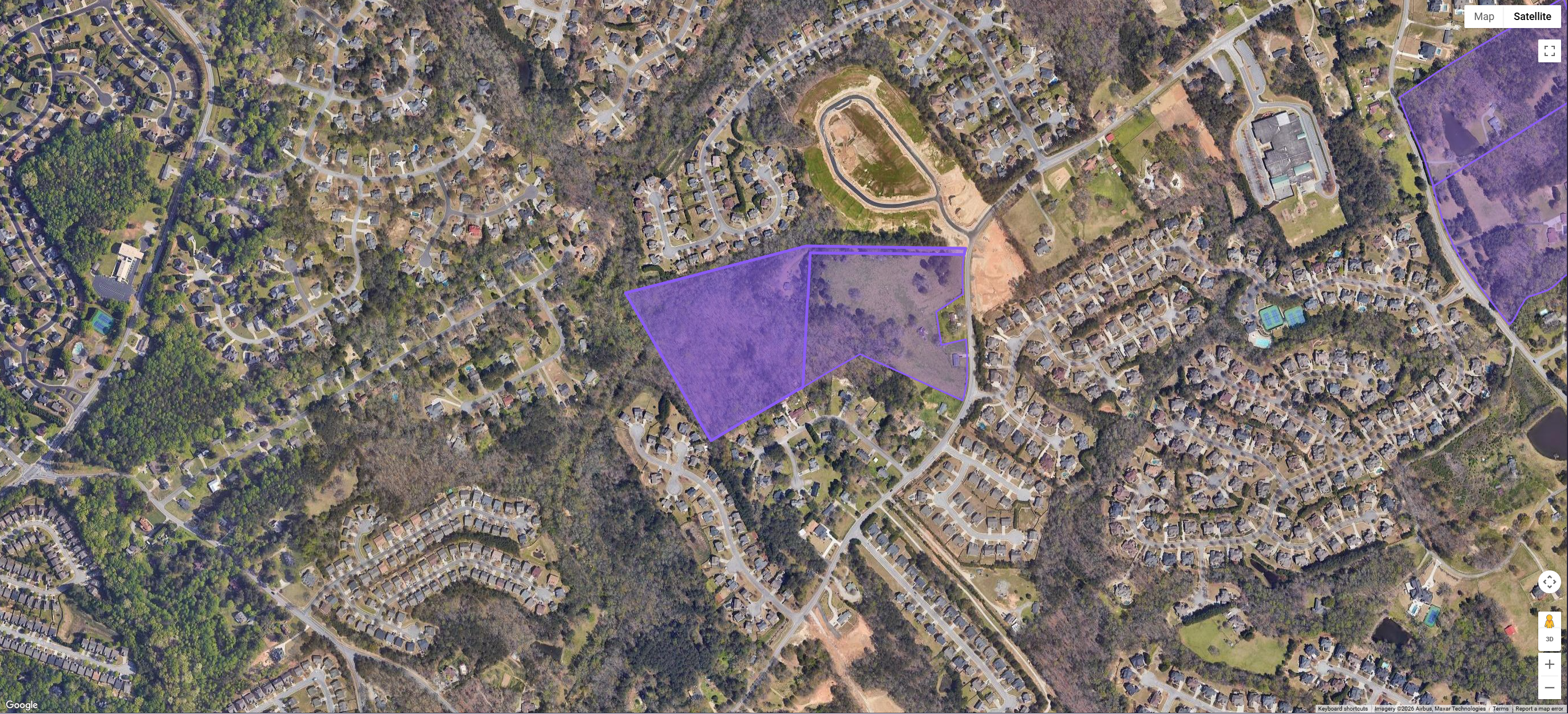
Single-Family Detached Subdivision
2538 & 2570 Kilgore Road
30.28 acres · 75 units
RA-200 → OSC
Applicant: Simes Signature Properties Inc.
View full caseSingle-Family Detached Subdivision
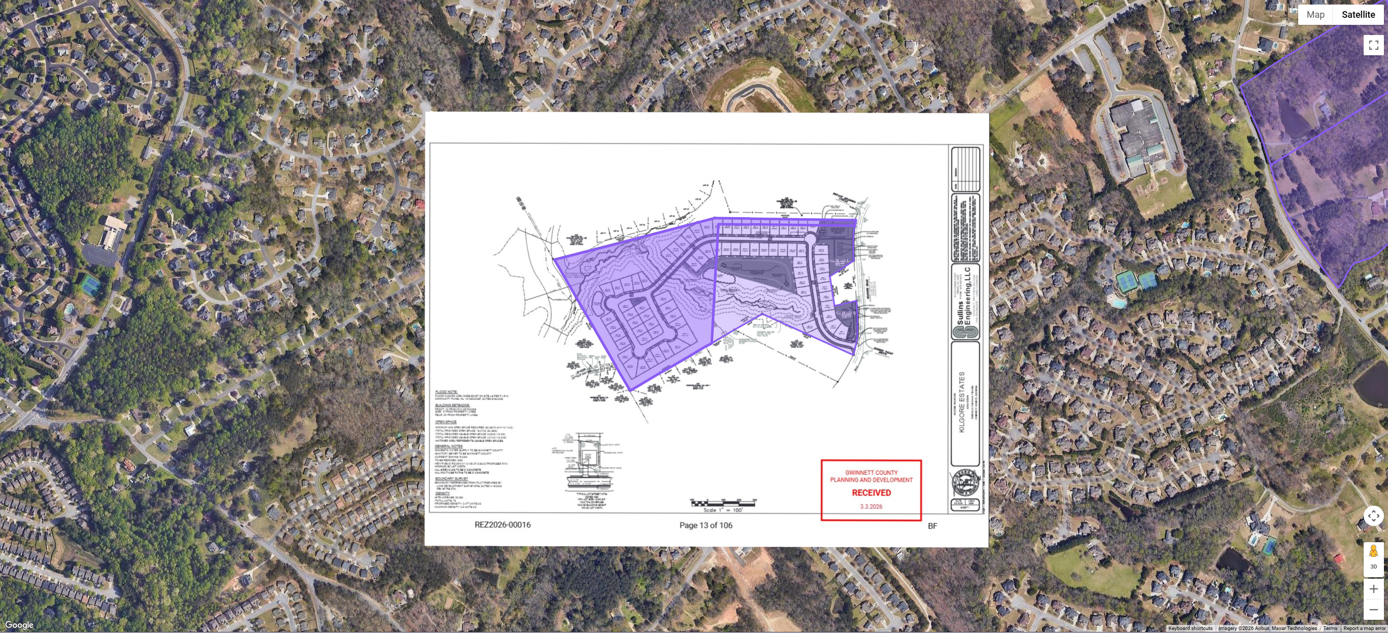
2538 & 2570 Kilgore Road
30.28 acres · 75 units
RA-200 → OSC
Applicant: Simes Signature Properties Inc.
View full caseAdjust opacity to compare the plan with the property
Available data varies by jurisdiction based on what is published in the public record.
The LandScout Standard
Built from the public record. Verified by people.
Rezoning data is too fragmented and consequential to trust automation alone.
AI-first tools can produce clean-looking records while inventing owner relationships, dropping a pin instead of mapping the affected land, or splitting one rezoning into separate cases when identifiers change between boards. They can even create cases that do not exist by misreading meeting dates or agenda references. LandScout cross-checks the public record before a data point enters the database.
Reviewed by humans
Every case is checked before it enters the database. LandScout cross-checks the public record rather than accepting an automated extraction as fact.
Linked to source materials
Each record connects back to the public materials behind it, so your team can verify the details without rebuilding the research from scratch.
Mapped to parcels
Cases are mapped to the actual affected parcels, not an approximate address, government office, or meeting location.
Built for teams that need the record to be right before they act.
AI-first tools vs. LandScout
AI-first tools: document extraction and map pins
LandScout: human-verified case records
AI-first tools vs. the LandScout standard
AI-first tools
Document extraction + map pins
LandScout
Human-verified case records
Hallucinated owner
AI-first tools
LandScout
Owner verified via parcel records
A pin is not a parcel
AI-first tools
Address-level
1234 Highway 92
Approximate location only
LandScout
Parcel-level
Affected land mapped
Broken case history
AI-first tools
Recorded as 2 separate cases
Case 1
PC
RZ-24-017
Case 2
BOC
2026-019
LandScout
One continuous case history
Case key
RZ-24-017
Jan 8, 2026
Planning Commission
Jan 22, 2026
Board of Commissioners
Hallucinated owner
Owner verified via parcel records
A pin is not a parcel
Address-level
1234 Highway 92
Approximate location only
Parcel-level
Affected land mapped
Broken case history
Recorded as 2 separate cases
Case 1
PC
RZ-24-017
Case 2
BOC
2026-019
One continuous case history
Case key
RZ-24-017
Jan 8, 2026
Planning Commission
Jan 22, 2026
Board of Commissioners
Extraction is not verification.
Track rezonings in your market
Each metro feed combines county and municipal cases into one view.
Research Triangle
Charlotte Metro
Metro Atlanta
Upstate SC
Greater Orlando
Myrtle Beach
Wilmington
Chattanooga
Charleston
Savannah
- County + municipal cases
- Parcel-linked records
- Meeting history
- Source documents
Get alerted when new signal hits
Set alerts around your buy box. LandScout notifies you when matching cases enter the database.
Target your buy box
Filter by county, stage, acreage, units, use, zoning, and keywords.
Stay early automatically
Get notified as matching cases appear so the right signal reaches you fast.
Alert preview
Gwinnett County · 14.2 ac · Single-family residential
Matches your saved filters · Just now
Cobb County · 6.1 ac · Multifamily
Case Z-2026-045
ActiveNotes:
Next hearing scheduled Aug 14. Site visit scheduled.
Case Z-2026-045 moved to Board of Commissioners with recommendation to approve → Email sent to team
5 minutes ago
Follow cases while they're still moving
Keep the parcel, documents, notes, and status history attached from first agenda item to final vote.
Keep context attached
Notes, tags, and source records stay with the case.
Follow movement
See when a case advances, stalls, or gets denied.
See what the zoning could actually support
Screen earlier without starting from a full zoning ordinance.
District limits
Lot size, density, height, setbacks, FAR.
Screen faster
Get to “worth a look” or “pass” sooner.